- Welcome to Cincinnati Museum Center
- Quick Tips
- Let's Get Started
- Welcome to Neil Armstrong Space Exploration Gallery
- Meet the Experts
- Exploring Space Exploration Gallery
- Imagine
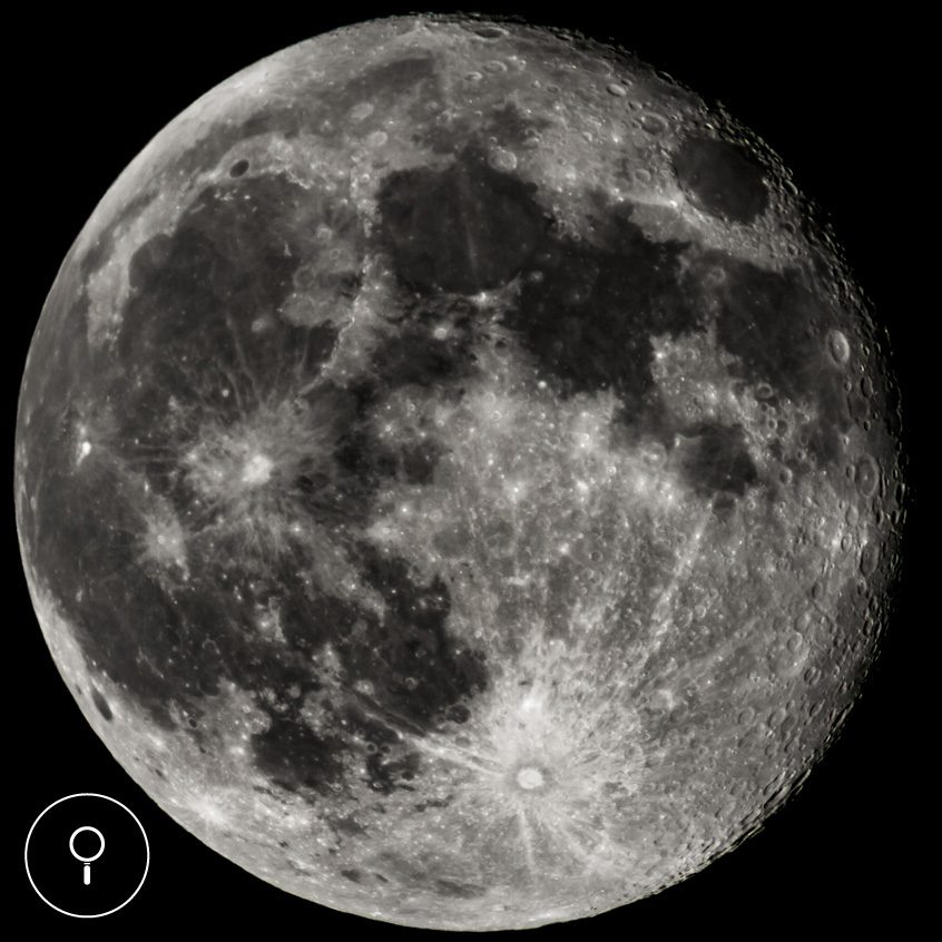
- Earth's Moon
- Earthworks and Lunar Cycles
- Constellations
- Spectroscopy
- Color the Universe Part 1
- Color the Universe Part 2
- Crater Maker
- Crater Activity
- Eclipses
- Protect
- View Going Up
- Space Photography
- Tropical Storm Images
- Microwave Imager
- Radar
- Sensing Microwaves
- Monitoring Infrared Radiation
- Global Climate Change
- Global Deforestation
- Deforestation Time Lapse
- Glaciers
- Polar Bear Tracking
- Mitigating Climate Change
- Climate Simulator
- Explore
- Experiments on the Moon
- Neil Armstrong
- Bok the Rock
- Flight Jacket
- EVA Suit
- Apollo 11 Team
- Years of Effort
- Mars Rover
- Artemis
- Survival on Other Worlds
- Artemis I Mission
- Artemis New Technology
- Innovations
- Thank You for Visiting CMC
Please click the on the right side of the screen to proceed.
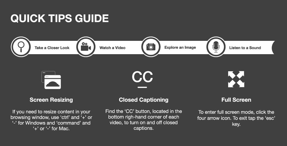
As you navigate your virtual adventure, you will become familiar with the following icons. You can always access the "Quick Tips" page through the top navigation bar.


If you need to resize content in your browsing window, use 'ctrl' and '+' or '-' for Windows and 'command' and '+' or '-' for Mac.

Find the 'CC' button, located in the bottom right-hand corner of each video, to turn closed captions on and off.

To enter full screen mode, click the four arrow icon. To exit, tap the 'esc' key.
Cincinnati Museum Center
Neil Armstrong
Space Exploration Gallery
Imagine how humans have used lunar cycles and found shapes in the stars, explore the journey of Neil Armstrong to the moon and what today’s Artemis missions will accomplish, and how we can use views from space to protect our planet from climate change.
MEET THE EXPERTS!
Meet the experts from Cincinnati Museum Center and partnering learning institutions that will be guiding your virtual adventure!

Cincinnati Museum Center

Astronomer, Cincinnati Observatory

Cincinnati City Council Member & Chair-Climate, Environment and Infrastructure Committee
IMAGINE
For millennia, humans have looked up and tried to understand what they see in the sky. Some seek answers in ancestral knowledge and legend, while others look to scientific exploration.
Credit: Pixabay
EARTHWORKS AND LUNAR CYCLES
There are other observable cycles related to the sun and the moon. During the Middle Woodland period, the indigenous people of the Ohio Valley and surrounding areas built monumental earthworks to mark some of these longer cycles. Every year, the sun appears to move north and south. In the northern hemisphere, the northernmost sunrise and sunset occurs on the summer solstice, and the southernmost sunrise and sunset happens on the winter solstice.
Winter Solstice Count Down
(December 21, 2022 at 4:47PM EST)
Click the icons to learn more!

Lunar Patterns

Moonrise Cycles

Earthworks
CONSTELLATIONS
Making Connections
Many cultures have looked at the patterns made by the stars and told stories to explain what they see. The star patterns helped them remember and pass down their stories.

Constellations
COLOR THE UNIVERSE
Now that we have high-powered telescopes like the James Webb Telescope, and advanced spectrometers, we can learn more about the universe than ever before.
The light we see is only a small portion of the electromagnetic spectrum. Objects in space, like stars, galaxies, pulsars, and nebulas, shine in other parts of the spectrum. By looking at the X-ray, radio, infrared, and ultraviolet portions of the electromagnetic spectrum, we can learn different information about these objects. Some objects, such as the remnants of supernovas, can be obscured behind large clouds of gas and dust. By filtering out infrared and visible portions of the spectrum, we can see what’s left of a supernova more easily.
Credit: NASA artist's concept of the James Webb Telescope
COLOR THE UNIVERSE
NASA’s most complex telescope, the James Webb Space Telescope, takes infrared photos like these photos of the Southern Ring nebula 2,500 light years away. By using cameras that detect different wavelengths of infrared light, we can learn more about the nebula. Look closely at the two pictures and point out the differences yourself.
Slide to compare Mid-Infrared instrument (MIRI) at left to Near-Infrared Camera (NIRCAM) at right
CRATER MAKER
We can also learn about space by looking at what falls to Earth. Most space rock burns up completely in the atmosphere, but occasionally a large meteorite impacts the surface with enough force to form a crater. Celestial bodies without a thick atmosphere, such as the moon, are covered in craters.
Scientists search for meteorites on Earth in Antarctica, where they are easier to find preserved in the snow. Meteorites can be as old as 4.6 billion years. Studies of these meteorites tell us about the makeup of the early solar system.

Crater maker
PROTECT
We have looked up at the sky for centuries. By launching rockets, satellites and crewed spacecraft into space, we can get a much more complete look at the Earth.
Credit: Pixabay
SPACE PHOTOGRAPHY TIMELINE
High above in the exosphere, satellites were first used by scientists to collect data and take photographs. As technology advanced, our photos became more precise.
Although scientists still utilize regular photography, they can study the earth in new and important ways by using spectroscopy, radar, LIDAR, ultraviolet and infrared cameras and other technology aboard satellites and spacecraft. Let’s take a look at how scientists use different technologies on satellites to learn about Earth.

TROPICAL STORM IMAGES
This photo of tropical storm Aletta was taken in June of 2018 by NASA’s Terra satellite. Images like this aren’t anything fancy. If you were looking from space at Aletta, you’d likely see this exact image.

NASA’s Terra satellite
This photo it is also a photo of Aletta. Looks different, doesn’t it? This photo was taken with different equipment on a different satellite, called the GPM Core Observatory satellite.

Click to the next page to see how this image was taken.
MICROWAVE IMAGER
First, the GPM used its Microwave Imager. The imager operates like the camera on your smartphone, but where your camera ‘sees’ visible light, the GMI ‘sees’ microwave radiation.

Using its Microwave Imager, the satellite collects data about microwaves coming from Earth, which helps it model how much rain is coming down at different places in the storm. It then uses that data to create storm maps such as this 2D image of Aletta.

RADAR
The second important instrument on the GPM satellite is its radar.


Satellite Radar

Satellite Radar Data
SENSING MICROWAVES
Sensing microwaves and using radar are just some of the neat ways satellites learn more about our planet. But what other ways can scientists use satellite data? Radar can also be used to record sea-surface height, which not only allows us to see how the ocean is changing over time but also helps us get an idea of what the bottom of the ocean looks like.

GLOBAL CLIMATE CHANGE
We are living in a world changed by human activity, and you can see the effects of this activity from satellites, too. In our reality of changing climate, looking down on our planet can help us research and ultimately protect our home.
GLOBAL DEFORESTATION
Deforestation is difficult to detect with the naked eye, so scientists are training computers to do the heavy lifting. By analyzing satellite photos, computers can detect deforestation and predict where deforestation will likely happen.
DEFORESTATION TIME LAPSE
Similarly, scientists use satellite and aerial images to understand how trees help cool temperatures in cities. By using infrared satellite images, scientists have learned that trees can cool an area’s temperature by as much as ten degrees Fahrenheit. Knowing this, decision makers in Cincinnati have pledged to increase tree cover to at least 30% in all residential neighborhoods.

Deforestation in South America
Astronaut photograph ISS043-E-101541 of Cincinnati/Northern Kentucky was acquired on April 10, 2015. NASA Earth Observatory.
POLAR BEAR TRACKING
But what about the polar bears living on the melting ice caps? How have they been reacting to their shrinking habitat? Where do they go when the ice melts? Ecologists and zoologists use GPS to track wildlife, especially those threatened by climate change, like the polar bear. Take a look at how far a polar bear can travel using the International Polar Bear Tracker.
MITIGATING CLIMATE CHANGE
Scientists are working to mitigate climate change – and you can help, too. There are lots of different ways to join the effort.

Cincinnati City Council Member Meeka D. Owens discusses what is happening in Cincinnati and how we can help.

Choices

Working Together
Source: Shutterstock/Bryan Busovicki
CLIMATE SIMULATOR
By participating in democracy, you can also support candidates that advocate for the changes you’d like to see in the world. Those candidates can influence climate policy and funding.
Policy can also influence the decisions corporations make. Since 1988, 100 companies have been responsible for 71% of the planet’s carbon emissions. Some companies have acted to reduce their carbon footprint, but their actions don’t come close to the sweeping reforms we need to live more sustainably on Earth.
Climate change is a huge problem, one that needs an equally huge response. Through policy, we can protect the future of our planet. Use the climate policy simulator to see the different ways policy can impact climate change.”
Please close the new browser tab to return to this presentation.
EXPLORE
On July 20, 1969, after years of intensive research, calculations, and physical training, humankind took its first steps on the moon.

Neil Armstrong, Edwin “Buzz” Aldrin and Michael Collins were Earth’s first ambassadors to the moon during the Apollo 11 mission.

Moonwalk and Lander

Crater
EXPERIMENTS ON THE MOON
While the focus of the Apollo 11 mission was traveling to and from the moon safely, NASA also wanted to learn more about the moon’s environment. During the 21 hours that they were on the moon, Armstrong and Aldrin took pictures, collected soil and rock samples and set up experiments while Michael Collins orbited the moon overhead.

Moon Experiment I

Moon Experiment II
NEIL ARMSTRONG
In Cincinnati, Neil Armstrong was a community leader. He worked with local organizations like the YMCA, the Ohio Commission on Public Service and Cincinnati Museum Center, serving as a member of the board of trustees for nine years.

Neil Armstrong was from Wapakoneta, Ohio, but after retiring from NASA in 1971, he settled down in Cincinnati, where he taught aerospace engineering at the University of Cincinnati and Purdue University.
BOK THE ROCK
FLIGHT JACKET
This flight jacket was worn by Neil Armstrong during the Apollo 11 mission. The patches on the jacket give important information about the astronaut and the mission.
→
Click the icons on the right side of the screen to learn more


EVA SUIT

Click to explore a replica of Armstrong's EVA suit.

Armstrong's EVA Suit and Snoopy Cap
APOLLO 11 TEAM
Buzz Aldrin, Michael Collins, and Neil Armstrong were just one piece in the enormous puzzle of sending people to the moon. The pivotal landing was made possible with the efforts of more than 400,000 people. Click around the gallery to view the stories of different individuals who made the Apollo 11 mission a success.

Norm Cassen

Katherine Johnson

Betty Love

John 'Jack' Garman
“We had hundreds of thousands of people all dedicated to doing the perfect job.”
– Neil Armstrong
YEARS OF EFFORT
Getting to the moon took years of effort. Planning for a return to the moon, and eventually Mars, is a process that will take decades. The International Space Station, whose first component was launched into space in 1998 and has housed astronauts since 2000, is an important step in the process. We are learning how to manufacture items and best grow food in space, among other crucial investigations.

Space To Ground: ISS Update

ISS Astronaut Q&A with Students
MARS ROVER
We traveled to the moon more than 50 years ago, but some destinations are still too far away for us to visit. Instead, NASA has sent several rovers – data-collecting robots – to Mars to explore the Red Planet. These rovers are outfitted with an array of different technologies for remote research, such as cameras for taking pictures, instruments for measuring temperature and wind and drills for taking samples of the surface.

Mars Rover Communication
Mars is incredibly far away, so rovers must be programmed to run without direct piloting from Earth.
ARTEMIS
In 1972, humankind took its last trip to the moon, but looking forward, there are new plans being developed for future space travel. One of these is NASA’s Artemis program. Artemis is the first step to establish a sustainable presence on the Moon to prepare for missions to Mars, providing opportunities for scientific discovery, economic benefits, and inspiration for a new generation of explorers.

Artemis Mission
SURVIVAL ON OTHER WORLDS
Mars is much farther away than the moon, so it is important for us to understand how to survive on other worlds if we want to visit our planetary neighbor.
To learn more, NASA is planning the first moon landing in fifty years, where a team of scientists will explore what it takes to survive off-planet.
NASA is also focused on broadening who travels in space. The Artemis program will include the first woman and Person of Color to go to the moon.
Earth and the moon, October 3, 2007, by camera on NASA's Mars Reconnaissance Orbiter. NASA/JPL-Caltech/University of Arizona
ARTEMIS I MISSION
The first step in the long road to Mars is the Artemis I mission. Artemis I will not have anybody onboard but will give vital information for the future of space travel. During this mission, NASA will test its Orion spacecraft and a new, powerful rocket called the Space Launch System.
Basalt and Anorthite are types of minerals found on the lunar surface.
INNOVATIONS
The reality of space travel is changing in new and innovative ways. From the first moon landing in 1969 to the future of the Artemis missions, our connection to the stars is growing right before our eyes.
Alongside scientists, entrepreneurs are also interested in space travel.

Space Mining
Some companies are interested in mining minerals from asteroids and other planetary bodies.
SpaceX Falcon 9 rocket launches with Inpiration4 crew.
Credit: Julia Bergeron for NSF; spaceflight.com
THANK YOU FOR VISITING
Thank you for exploring the Neil Armstrong Space Exploration Gallery. To discover more, check out our other virtual field trips and a wide array of online resources, including our WonderZone videos and the Learning from Home section of our website. Visit https://www.cincymuseum.org/learning-from-home
To explore CMC’s epic exhibits, such as Space, in-person, click the button below to purchase tickets. *Due to COVID-19, some exhibits may be closed. Please check www.cincymuseum.org prior to visiting for the most up-to-date list of open experiences.
To reserve other Virtual Field Trip experiences, click the button below to explore CMC’s current offerings! Remember to always check back, as we frequently add new experiences.
